
Microsoft Fabric Maps & Real-Time Intelligence Consulting: Imagery, Mapping & Dispatch Solutions
OnTerra Systems provides Microsoft Fabric Maps and Real-Time Intelligence consulting for organizations that need to see, analyze and act on location data as it happens. We stream high-resolution imagery into Fabric Maps, fuse live events with your GIS and asset data in Real-Time Intelligence, and dispatch field crews with optimized routes, all inside your own Fabric tenant. A Microsoft partner since 2005.
Fabric is the platform. The value is in the solution.
Microsoft Fabric brings OneLake, Data Factory, Real-Time Intelligence, Fabric Maps and Power BI together on one capacity. But Fabric does not arrive with your imagery, your asset data or your dispatch rules — that is the work that turns a Fabric investment into an operational result.
Spatial data lives in many formats and systems. Getting it into Fabric, joined with live events and acted on in the field takes integration experience most teams don’t have in-house.
A Microsoft partner since 2005, OnTerra has delivered mapping and routing solutions on Microsoft platforms for more than 20 years. We bring a proven reference architecture, imagery, data and optimization services.
A working solution in your tenant: maps with current and historical imagery, live operational layers, automated alerts and routed crews.
Microsoft Fabric Maps Real-Time Intelligence Consulting Services
Imagery & GIS layers in Fabric Maps
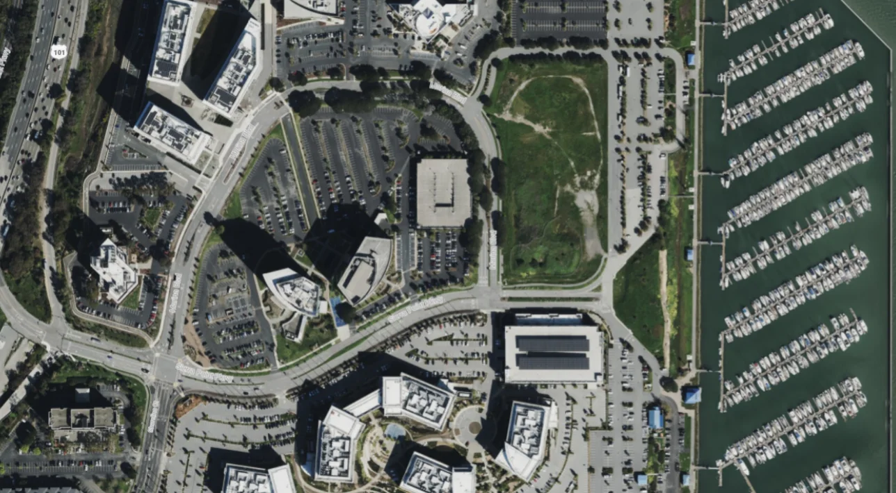
MapSavvy WMS/WMTS streams high-resolution aerial imagery (down to 7.5 cm), color infrared and surface elevation straight into Fabric Maps — with about 15 years of historical vintages for change detection. Imagery is streamed, not copied into OneLake, and each customer gets a dedicated endpoint.
Spatial data integration & conversion
We load your GIS, CAD, asset and street data into OneLake and Lakehouse layers (GeoJSON, PMTiles, Cloud Optimized GeoTIFF), connect existing Esri or OGC feature services, and handle the format conversions in between — including SQL Server spatial and Esri formats.
Real-Time Intelligence build
Eventstream ingestion of GPS, sensor and work-order feeds; Eventhouse KQL for geo joins, H3 aggregation and risk ranking; Activator rules that open work orders automatically; and Real-Time Dashboards your operations team will actually use.
Route optimization & dispatch
RouteSavvy API PLUS, available on the Microsoft Marketplace, is called from Fabric notebooks to assign and re-optimize multi-vehicle routes with time windows, technician skills and mid-day changes — capability Fabric does not provide natively.
Curated data store
Curated, ready-to-use geospatial datasets delivered into OneLake, so your team starts from clean reference layers instead of raw downloads.
Proof of concept & enablement
A working proof of concept in your own Fabric tenant using your data, followed by production hardening, documentation and hand-off so your team can operate and extend the solution.
One architecture, every industry
Only the imagery source and data change from one solution to the next.
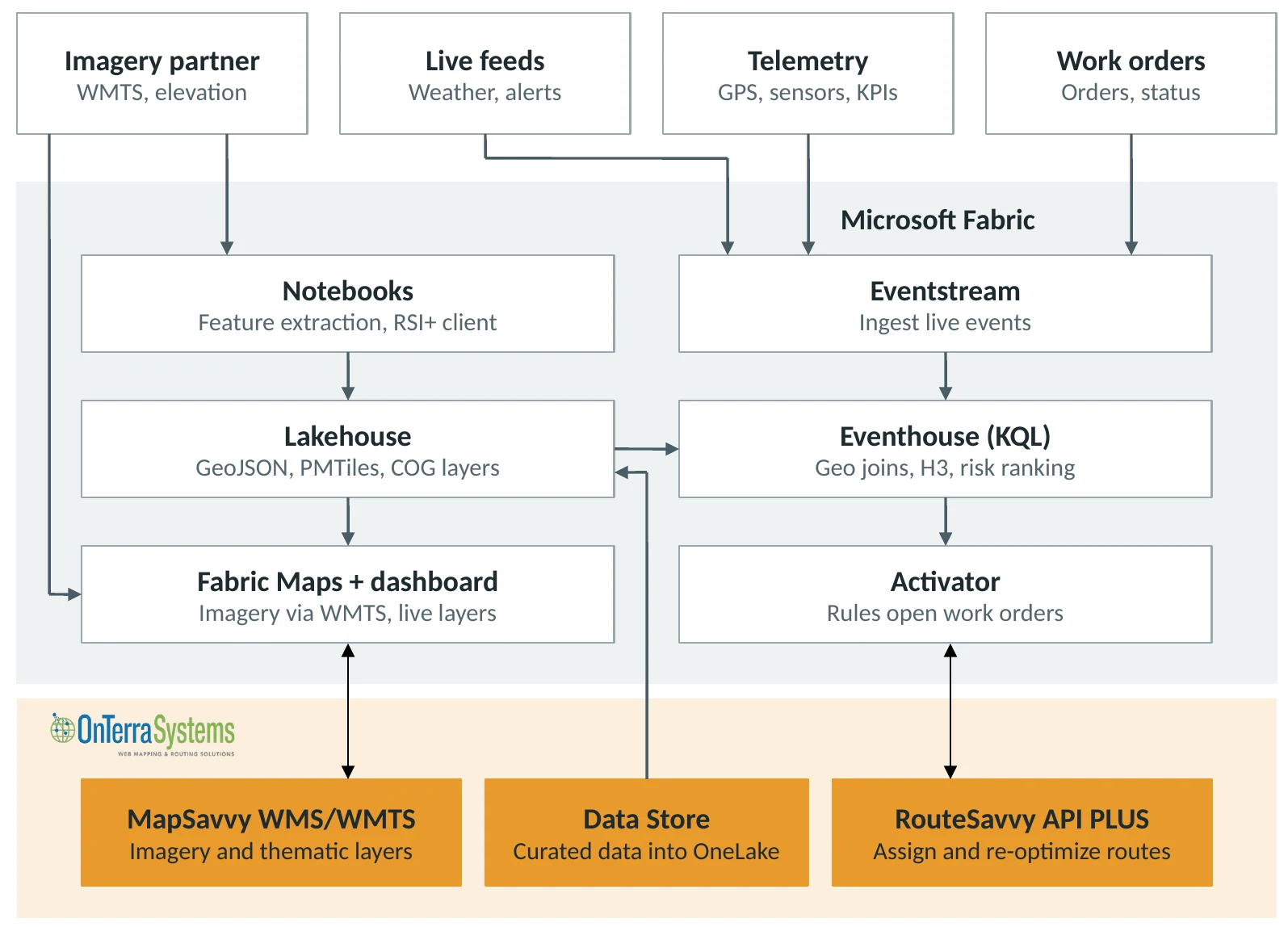
Imagery streamed into Fabric Maps via WMTS; nothing copied into OneLake.
Notebooks turn imagery and elevation into features and surfaces stored as Lakehouse layers.
Live events are joined to stored features in the Eventhouse; Activator opens work orders and RouteSavvy API PLUS dispatches.
Working in Microsoft Fabric
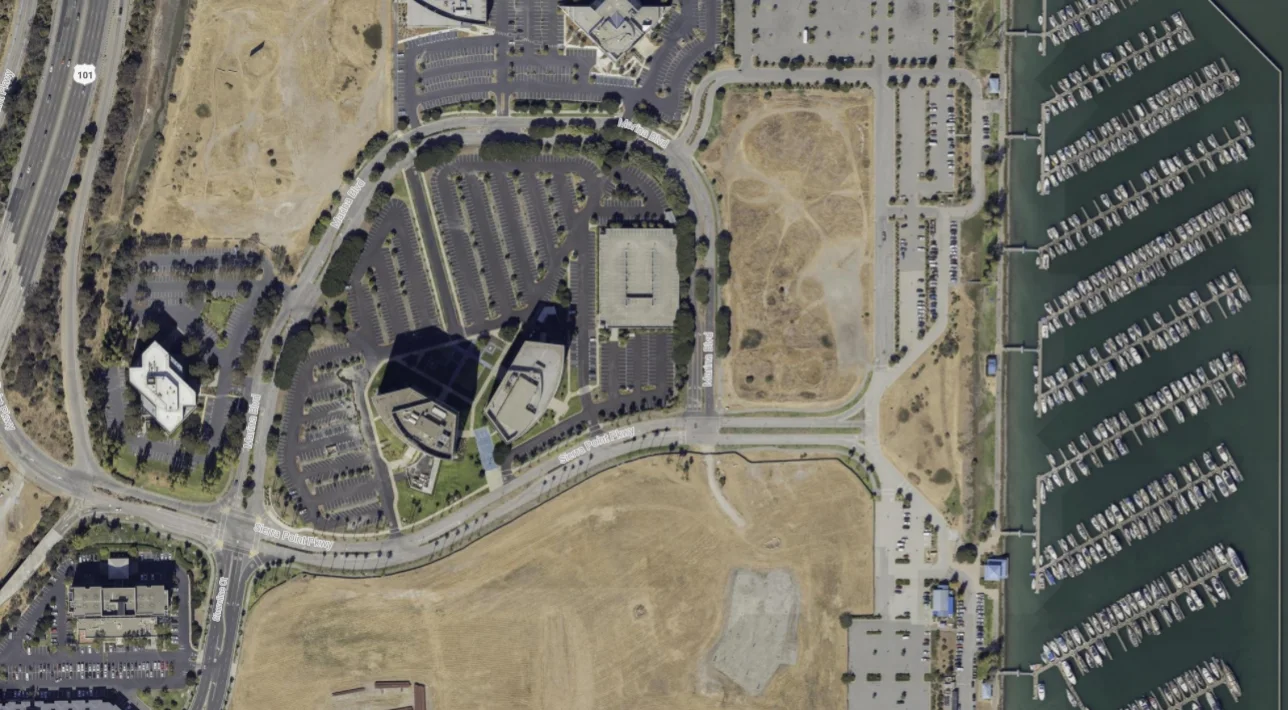
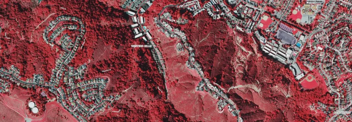
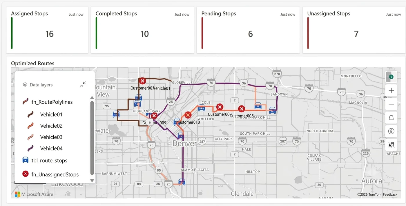
Screenshots from OnTerra’s Fabric environment.
Solution patterns by industry
Each pairs Fabric Real-Time Intelligence with RouteSavvy API PLUS dispatch and a premium imagery source. Solutions for agriculture and mining are also available.
Logistics & field service
Live vehicle and technician locations streamed into Fabric and matched against orders, time windows and service territories. Alerts flag late or off-route stops, RouteSavvy API PLUS re-optimizes routes mid-day as jobs are added, cancelled or delayed, and dashboards show completed, pending and unassigned work at a glance.
Utilities & telecom
Vegetation and canopy height along overhead lines, derived from high-resolution imagery and elevation, combined with live weather. When high winds meet high-risk spans, risk is ranked across the network, patrol or trim work orders open automatically and crews are routed to the riskiest segments first.
Energy & pipeline
Live pressure, flow and gas-detection alarms placed on the map beside facilities and rights-of-way. Surface models help spot encroachment and ground change along corridors, and alarms trigger inspection work orders dispatched to the nearest qualified technician.
Emergency services
Live incidents, unit positions and hazard perimeters in one operational picture. Find the nearest available unit, see which structures and roads fall inside a new fire or flood perimeter, and route inspection and response crews with current imagery behind every decision.
Government & smart city
IoT sensors, 311 requests and city GIS layers brought together with current imagery. Track tree canopy, impervious surface and asset condition by district, raise alerts when thresholds are crossed and schedule public works crews efficiently across the city.
Insurance & event response
Policy locations overlaid with hail and wind footprints as storms happen. See exposed and affected policies within minutes, compare pre- and post-event imagery, prioritize the claims queue and route adjusters to the most urgent inspections.
From discovery to production
Every Fabric solution depends on your data and systems, so every engagement starts with a conversation.
- 1
Discovery session
We meet with your team to understand the business problem, your current use of Microsoft Fabric and capacity, and the outcomes you need.
- 2
Data & requirements review
Where your data comes from, what formats and systems it lives in, which live feeds matter, and the specific map, alert and dispatch features required.
- 3
Scoping & solution design
We map your requirements onto the reference architecture, select imagery and data sources, and define success criteria for a proof of concept.
- 4
Proposal
A written proposal with scope, deliverables, timeline and cost — plus any data or API licensing required.
- 5
Proof of concept
A working build in your Fabric tenant on your own data, typically in 1–2 weeks, reviewed with your stakeholders before full investment.
- 6
Production & support
Production deployment, monitoring, documentation and ongoing support, with new layers, rules or industries added as needs grow.
Frequently Asked Questions
Do we need Microsoft Fabric already?
Yes. These solutions run inside your Fabric tenant on your own capacity. If you are still evaluating Fabric, the discovery session will help you decide whether Real-Time Intelligence and Fabric Maps fit your use case before you commit.
Is imagery copied into OneLake?
No. Imagery is streamed into Fabric Maps from MapSavvy over WMS/WMTS. Only derived features — such as vegetation risk, canopy height or corridor buffers — are stored as Lakehouse layers.
Can Fabric optimize routes on its own?
Fabric can display routes and react to events, but multi-vehicle route optimization is not built in. RouteSavvy API PLUS fills that gap and is called directly from Fabric notebooks.
Is this a packaged product we can download?
No. Every deployment depends on your data, systems and feeds, so each engagement starts with discovery and scoping. The reference architecture and industry patterns shorten delivery, but the solution is built around your requirements.
What is Microsoft Fabric Real-Time Intelligence?
Real-Time Intelligence is the part of Microsoft Fabric that ingests, analyzes and acts on streaming data as it arrives: Eventstream for ingestion, Eventhouse and KQL for analysis, Real-Time Dashboards for monitoring and Activator for automated alerts and actions.
What is Fabric Maps, and what can it display?
Fabric Maps is the map visual in Microsoft Fabric. It shows location data from Lakehouse files and Eventhouse queries on an Azure Maps basemap, with tile layers such as high-resolution aerial imagery streamed from MapSavvy. Layers can update live as new events arrive.
How long does a Fabric Maps proof of concept take?
Typically 1–2 weeks, built in your own Fabric tenant on your own data. Discovery and scoping come first, so the proof of concept targets agreed success criteria.
What does Microsoft Fabric Maps consulting cost?
It depends on scope: the data sources, live feeds, users and integrations involved. Every engagement starts with a free discovery session, followed by a written proposal with scope, timeline and cost before any work begins.
Can we use Azure Maps or HERE data in Fabric Maps?
Yes. Fabric Maps uses Azure Maps for its basemap, and location data from HERE, Azure Maps services or your own GIS can be loaded into Fabric as map layers. OnTerra licenses Azure Maps and HERE.
We’re migrating off Bing Maps. Can Fabric Maps replace it?
Not directly. Fabric Maps is for analytics and dashboards inside Microsoft Fabric, not a map control you embed in your own applications. Microsoft’s replacement for Bing Maps for Enterprise is Azure Maps, and OnTerra handles Bing Maps to Azure Maps migrations. Many organizations use both: Azure Maps in their apps and Fabric Maps for operations and analytics.
How do Microsoft sellers and partners work with OnTerra?
Bring us into Fabric opportunities that involve maps, imagery, field operations or dispatch. We join customer calls as the geospatial solution and technical team, and co-sell alongside you.
Need Fabric Maps & Real-Time Intelligence consulting?
Book a discovery session and we’ll walk through your requirements, data and the right starting point.
Book a Discovery Session