
Bing Maps Bird’s Eye Alternative for Azure Maps & HERE Maps
Bird’s Eye imagery retires with Bing Maps for Enterprise, and neither Azure Maps nor HERE Maps offers oblique imagery like Bird’s Eye. As a Bing Bird’s Eye alternative, OnTerra Systems adds Vexcel’s 45-degree oblique imagery to Azure Maps and HERE Maps, so users keep the angled aerial views they rely on.
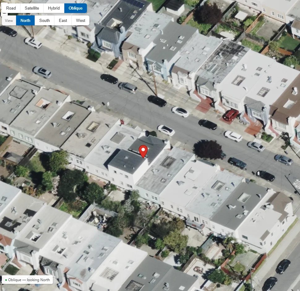
Migrating off Bing Maps shouldn’t cost you Bird’s Eye
Assessors, insurers, first responders, and field teams use Bird’s Eye to see building sides, entrances and roof lines that a straight-down image hides.
Azure Maps and HERE Maps, the two main Bing Maps successors, have road, satellite and hybrid views only. There is no oblique view to which users can switch.
OnTerra is a Vexcel reseller and has been a Microsoft mapping partner for more than 20 years. We license the imagery and build it into your Azure Maps or HERE application.
Users click Oblique in the same map, rotate north, south, east or west, and switch back, with their pushpin in the same place.
Bird’s Eye after Bing Maps
| Capability | Bing Maps Bird’s Eye | Azure Maps | HERE Maps | Azure or HERE + Vexcel (OnTerra) |
|---|---|---|---|---|
| 45° oblique imagery | Yes (retiring 2028) | No | No | Yes |
| North, south, east and west views | Yes | No | No | Yes |
| Pushpin kept when switching views | Yes | — | — | Yes |
| Road, satellite and hybrid views | Yes | Yes | Yes | Yes |
| Street and address labels on oblique | Yes | — | — | Not available |
| Supported after June 30, 2028 | No | Yes | Yes | Yes |
Oblique view in the OnTerra column comes from Vexcel imagery added to the Azure Maps or HERE map control.
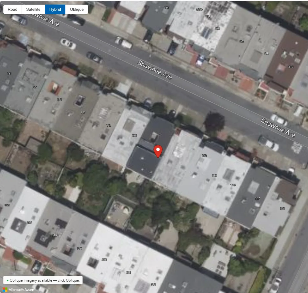
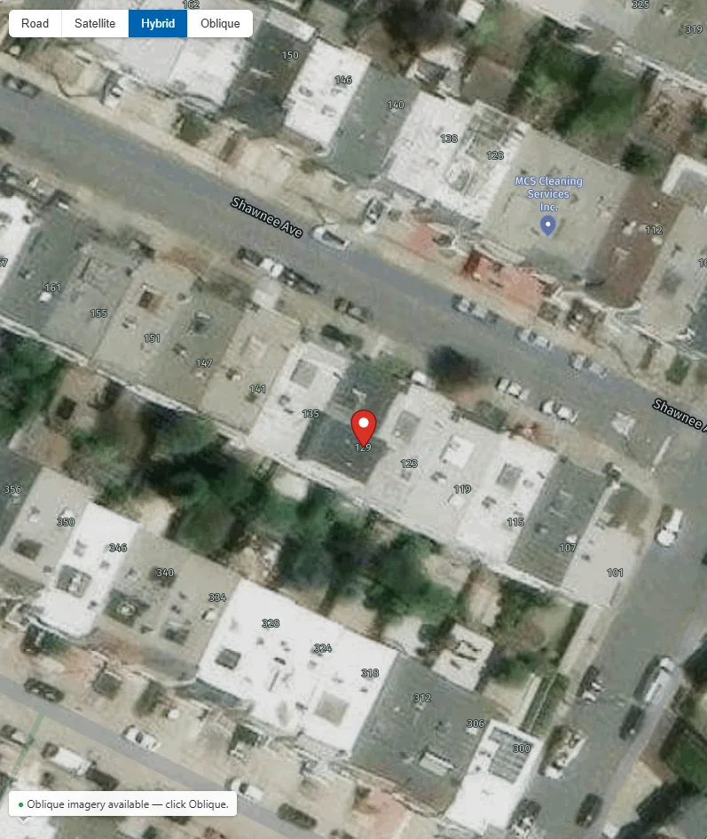
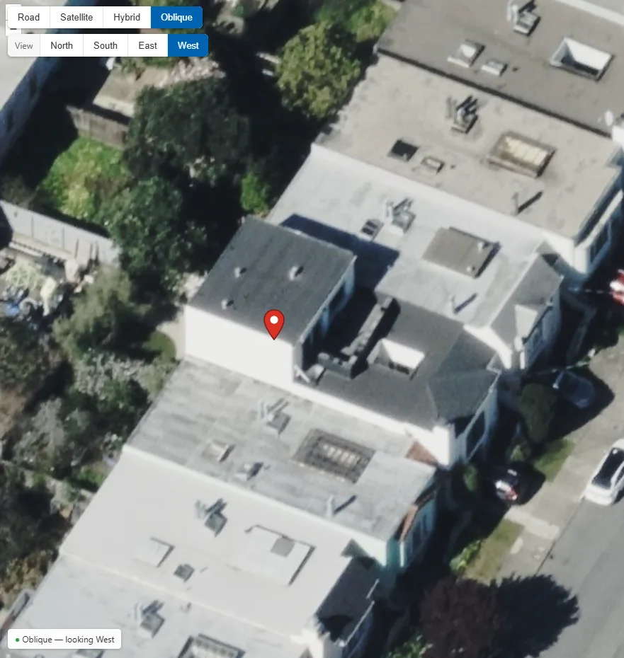
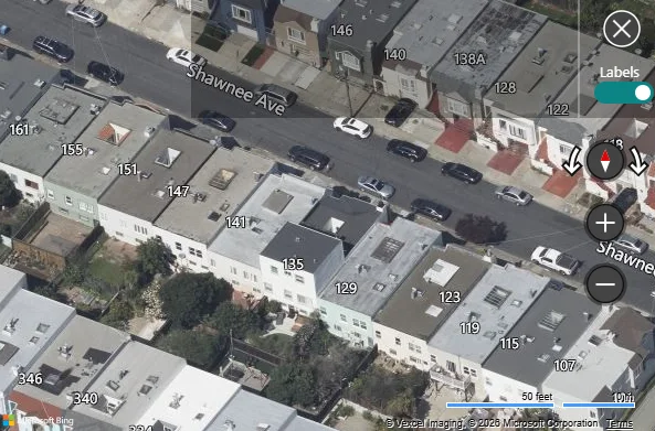
Same address, same map, now with oblique
Working builds from OnTerra’s development team: Vexcel oblique imagery loaded alongside the Azure Maps and HERE map controls.
Bird’s Eye replacement services
Oblique view in your map
Vexcel’s map control loaded with your Azure Maps or HERE control: an Oblique choice in the map-type selector, four viewing directions, and the map position kept in step.
Your pushpins and data
The location your users selected stays pinned when they switch between hybrid and oblique views, so they never lose their place.
Imagery licensing
Vexcel licensing through OnTerra, sized to your users and areas, alongside your Azure Maps or HERE licensing if you need it.
Testing and handoff
A proof of concept on your own addresses, then production deployment, documentation and support.
Need more than Bird’s Eye? See Vexcel platform solutions for elevation, property data and AI-driven imagery analysis.
From discovery to production
Every engagement starts with a free Bing Maps migration assessment.
- 1
Discovery session
How your users rely on Bird’s Eye today, which application and map control it lives in, and where you are migrating.
- 2
Coverage check
We confirm Vexcel oblique coverage for your service areas and the imagery dates available.
- 3
Proof of concept
Oblique view working in your target map control, on your own addresses, for your team to try.
- 4
Proposal
Scope, timeline and cost for the build, plus Vexcel licensing.
- 5
Build & deploy
Production integration, testing and rollout alongside your Azure Maps or HERE migration.
- 6
Support
Ongoing support, licensing renewals and new features as your needs change.
Frequently Asked Questions
What happened to Bing Maps Bird’s Eye?
Bird’s Eye goes away with Bing Maps for Enterprise, which Microsoft retires on June 30, 2028. Azure Maps, Microsoft’s replacement for Bing Maps, has no Bird’s Eye or other oblique imagery, so applications that move to Azure Maps lose the angled view.
What are my options when the Bird’s Eye view is gone?
You can go without angled views, license oblique imagery directly and build the integration yourself, or have OnTerra add Vexcel’s 45° oblique imagery to your Azure Maps or HERE map so users keep a Bird’s Eye–style view. A free migration assessment shows which fits your application.
Do Azure Maps or HERE Maps have Bird’s Eye or oblique imagery?
No. Azure Maps and HERE Maps offer road, satellite and hybrid views only. Neither has 45° oblique imagery, so Bird’s Eye has no direct replacement on either platform.
Where does the oblique imagery come from?
From Vexcel Imaging, whose aerial collections are also credited in Bing Maps’ own Bird’s Eye view. OnTerra is a Vexcel reseller, so we license the imagery and build the integration.
Do we have to replace our map?
No. The oblique view is added to the Azure Maps or HERE map control you are migrating to. Users pick Oblique from the same map-type selector and switch back at any time.
Will oblique show street names and address labels like Bird’s Eye?
Not today. Bing Maps drew street, address and place labels on top of Bird’s Eye; Vexcel’s oblique imagery is supplied without them. Your pushpin stays in place on the oblique view, and we review label needs during discovery.
Is there oblique coverage where our users work?
Coverage depends on Vexcel’s collections. We check coverage for your service areas during discovery, before any commitment.
How to Keep Bird’s Eye After Bing Maps Retires
Book a free migration assessment and we’ll show oblique imagery working on your own addresses.
Book a Free Assessment